Today I visited the Master Plan exhibition at URA, and spent a lot of time going through their website.
Why should I care about the Master Plan?
The Master Plan guides development in Singapore. It is important to understand the principles that guide master planners. And if there are gaps in understanding the situation on the ground, it is up to us to highlight these issues. Those of us who know and care, MUST speak up. To tell planners where there are good examples of our marine heritage. So that these are taken into account during the planning process.
So please do try to visit the exhibition (more details on the URA website), and give your feedback. I will be sending links to these posts as feedback to URA on the Master Plan. If you prefer, you can simply add your comments to this blog.
What is the Master Plan?
The Concept Plan
The Concept Plan is Singapore’s strategic land use and transportation plan to guide development in the next 40 to 50 years. The Concept Plan is reviewed every 10 years.
The Master Plan
The Master Plan is the statutory land use plan which guides Singapore's development in the medium term over the next 10 to 15 years. It is reviewed every five years and translates the broad long-term strategies of the Concept Plan into detailed plans to guide development. The Master Plan shows the permissible land use and density for every parcel of land in Singapore.
Concept Plan Review A mid-term review of the Concept Plan in 2006 concluded that there is sufficient land to cater to Singapore’s future needs while maintaining a good quality living environment. The broad strategies arising from the review are:
* Need to make better use of land: There is a need to make more creative use of land to meet future needs, such as using underground spaces and co-location of compatible uses.
* Decentralisation through new growth centres: New growth centres outside of the city are proposed at Jurong and Paya Lebar.
* Priority on public transport: Priority has to be given to the use of public transport to meet the increasing transportation needs.
* Enhancing Quality of Life & Sense of Identity: The quality of life can be enhanced by providing for a greater variety of leisure options. At the same time, there is also a need to selectively retain Singapore’s built and natural heritage to foster our sense of belonging.
How are our wild places seen in terms of urban planning? Our parks and nature places fulfil the 'Play' element of the 'Work, Live and Play' theme in urban planning.
 Nature is clearly a part of the leisure plan.
 Some of the designated activities include:
 As well as
 Other activities related to the marine environment include: marina and pleasure boating, sailing, kayaking/canoeing, water skiing/wakeboarding, fishing and scuba diving.
Other activities related to the outdoors include: dragonboat, water taxi, motorsports, golfing, horseriding, rollerblading and other sports
Non-outdoor activities considered include: shopping, lifestyle and dining, arts and culture and community.
Which are the areas designed with the sea star for "Marine Nature Spot"?
Chek Jawa at Pulau Ubin Labrador
 Pulau Semakau has a sea star. Pulau Hantu doesn't but it is the only location with a scuba diving icon.
 While there are a lot of different leisure icons for Sentosa, there are none for the Southern Islands nearby: Kusu, St. John's and the Sisters Islands.
 Sungei Buloh Wetland Reserve doesn't get a "sea star" but has all the other relevant icons.
 Changi doesn't get a "sea star"
 Neither does Pasir Ris.
 Do our shores exist?
On the big table top model of Singapore ... All our Southern Islands have dropped off the table.
 And there's only half of Pulau Ubin with Chek Jawa off the table.
In the panel devoted to Playing with Water ... Some of our Southern islands have also dropped off the map, including Pulau Hantu, the only location with the scuba icon, which is on the Water Activities Plan legend, but doesn't appear on the map.
 Is it a bad thing that urban planners know little about our shores?
While no news can be taken good news, it also does mean that plans will not take into account the presence of good reefs and our other shore habitats.
However, the planners do seem to have some awareness of the shores as a part of the lives of Singaporeans. In the panel featuring memories of physical places, there were lots of photos of people on the shores.
 Across time.
 Both natural and man-made shores.

 Trips to the Southern Islands.
 Even Chek Jawa!
 The life-vests suggest these are government visitors, and they are visiting before the boardwalk was built.
 Enthralled on Chek Jawa.
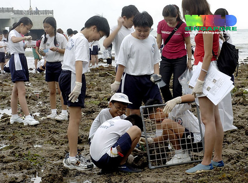 Living classroom at Labrador
 Delighted at Pulau Semakau.
 Exploring our City Reefs on Kusu Island. Just minutes from the city centre.
 Exploring Sentosa's surprising natural shores.
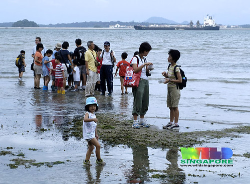 For all ages at Changi.
 Communing with wildlife on Chek Jawa.
Links to media articles on the Master Plan
- Transforming Singapore: Draft Master Plan 2008
Business Times 29 May 08 - Making of Singapore into a lively, liveable global city URA's Master Plan looks at softer features of urban life and new needs like population growth
Joyce Teo, Straits Times 24 May 08 - Singapore: Leisure Island
NOTHING to do on the weekends in Singapore? Not if its city planners can help it.
Jessica Lim, Straits Times 22 May 08;
To give your views on the redevelopment plans, visit the Draft Master Plan 2008 exhibition at The URA Centre, 45 Maxwell Road from now till June 20.
Opening hours are 9am to 7pm (Monday to Friday), and till 1pm on Saturday.
Those who object to the proposals should write in to the Permanent Secretary, Ministry of National Development, 5 Maxwell Road, Singapore 069110 - with supporting reasons - before June 20.


1 comment:
Is that possible to show the planners of URA the nature shores from time to time?
So that the new planners and the veteran planners will have a bit more awareness on the nature shores and can make their 'selection' better?
Or at least, they know who else they can seek public opinions on before they want to make the 'selection'.
May be by always put the nature shores in their minds, their selection would be, let the shores stay as they are.
It seems like URA is a very important government agency to decide the fact of the shores.
May be more 'work' need to be 'done' towards them.
Post a Comment